Connectivity Guide
How Dholera SIR is connected
Dholera SIR is planned as a large industrial and urban development region in Gujarat. Connectivity is a key part of the development framework because the region is intended to connect industrial activity with Ahmedabad, Bhavnagar and wider domestic and international markets.
The reference material for Dholera SIR describes multiple connectivity layers: highways and major roads, the Ahmedabad–Dholera corridor, proposed airport connectivity, rail and freight links, and nearby port access. Some facilities are operational, while others are planned or under development, so project-specific and current status should always be verified.
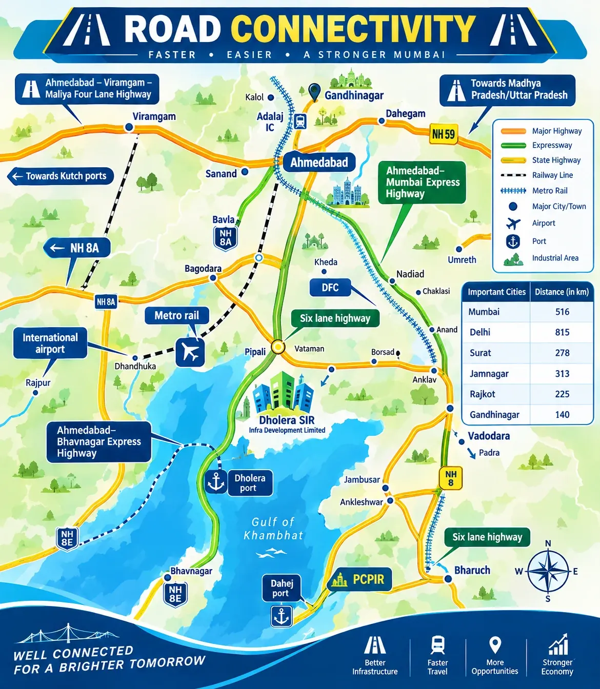
Road Connectivity
Road access forms the main day-to-day connection for Dholera. Project material highlights links towards Ahmedabad, Bhavnagar and other Gujarat routes, together with the planned and developed road network inside the SIR.
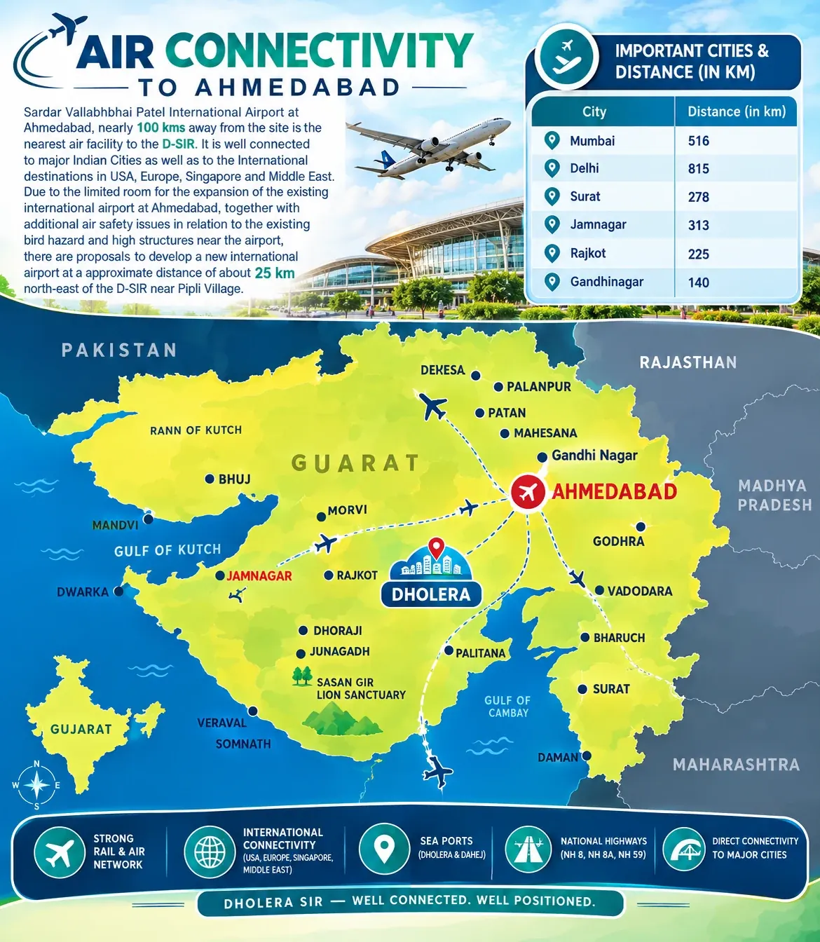
Air Connectivity
Dholera International Airport is part of the wider regional infrastructure plan. For travel planning or property evaluation, check the latest airport and road-access status rather than relying only on older project brochures.
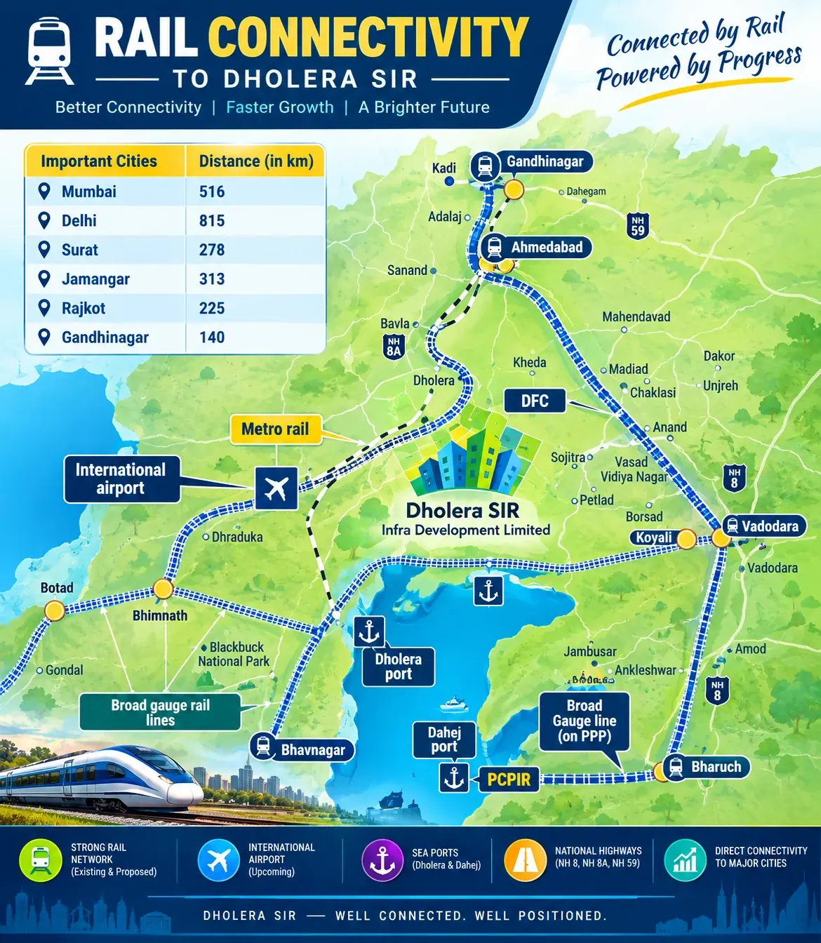
Rail & Freight Connectivity
Rail and freight infrastructure is important for an industrial region. Dholera's planning context is also linked with the Dedicated Freight Corridor and the wider Delhi–Mumbai Industrial Corridor ecosystem.
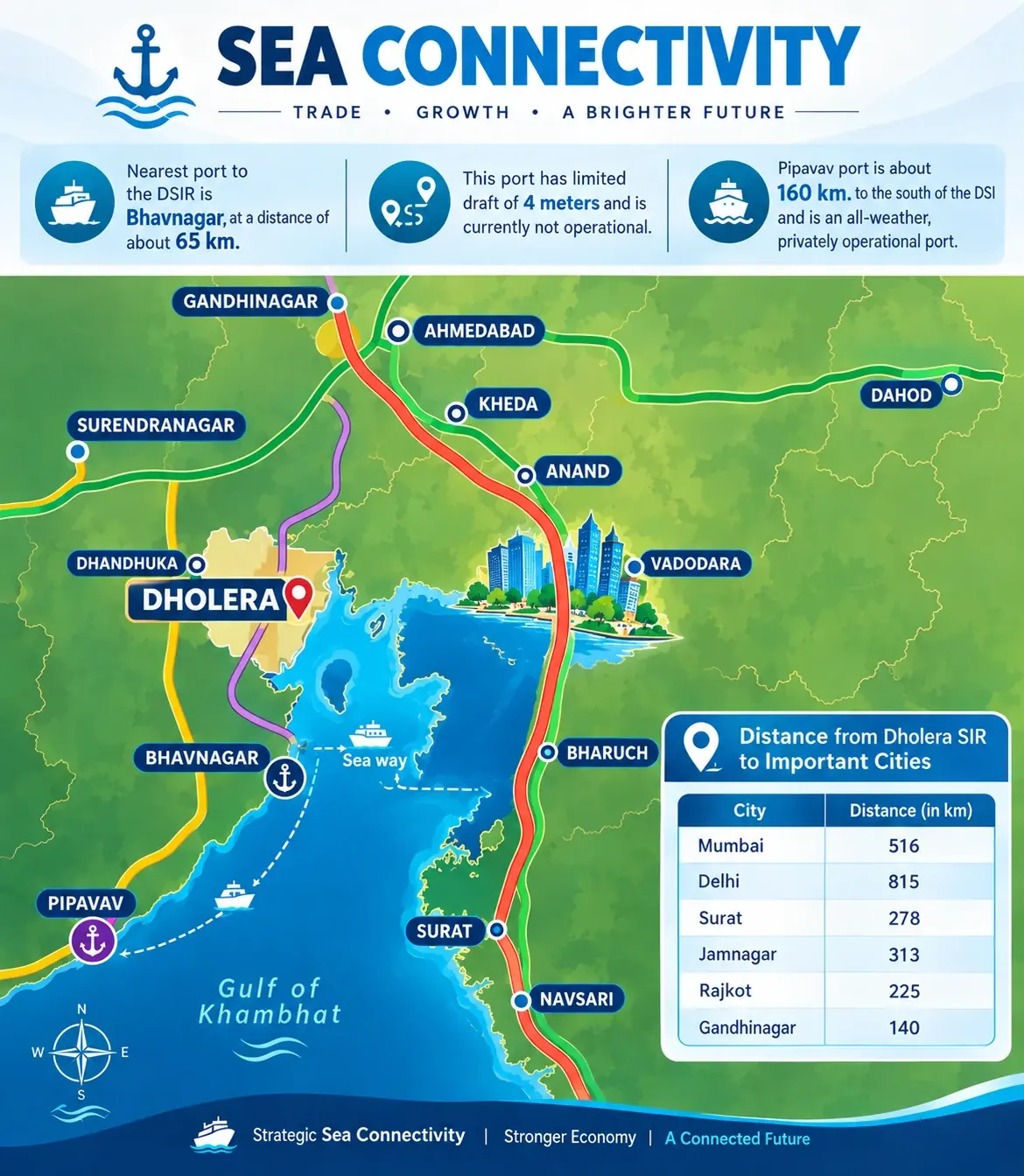
Sea & Port Connectivity
The Dholera region has a coastal location near the Gulf of Khambhat, and port connectivity is discussed in the broader development plan. Exact routes, operational status and timelines should be verified from the relevant authorities before making a decision.
At a glanceFive connectivity layers
RoadRegional highways and internal access roads.
AirportRegional aviation infrastructure.
RailPlanned regional and freight links.
DFCFreight-corridor ecosystem.
PortCoastal and logistics context.
DMICIndustrial-corridor integration.